Hyperspectral Imaging (HSI) captures hundreds of narrow spectral bands, forming a data cube in which each pixel has a unique spectral signature. This enables material identification, anomaly detection, change detection, and scene characterisation beyond the capabilities of conventional panchromatic or multispectral imagery. These capabilities make HSI a potent tool for pre-strike intelligence preparation (e.g., environmental baselining, camouflage detection) and post-strike assessment (e.g., high-level battle damage assessment, collateral-effects monitoring) when used within robust legal and ethical frameworks.
Commercial and dual-use space missions now place capable hyperspectral sensors on microsatellites and CubeSats, reducing costs, increasing revisit frequency, and enabling on-board processing for faster insight delivery.
Simera Sense’s HyperScape100 is a compact VNIR pushbroom hyperspectral imager engineered for nanosatellites. This payload supports 4.75 m GSD (500 km), 19 km swath, up to 32 user-selectable bands from >400 available (460–860 nm), ~1.26 kg mass, 4–8 W power, and 128 GB storage: features suited to on-orbit pre- post-event spectral analytics, provided appropriate tasking, illumination, and calibration.

1 Introduction: Why hyperspectral for assessment?
Key value propositions
- Material identification (e.g., coatings, soils, vegetation stress) using spectral fingerprints rather than colour alone.
- Anomaly and camouflage detection via algorithms that highlight spectrally atypical pixels or sub-pixel mixtures.
- Change detection for pre/post comparison, enabling higher-confidence, non-kinetic insights that can reduce unnecessary re-attack.
- Data fusion with other ISR (SAR, RF, thermal) for more robust assessments.
2 Principles of Hyperspectral Imaging
HSI sensors acquire tens to hundreds of contiguous narrow bands across the VIS–SWIR spectrum (and sometimes MWIR/LWIR). Each pixel’s spectrum forms a signature that can be matched against libraries or exploited statistically (e.g., for target detection or unmixing). Pushbroom systems sweep line by line across track, building a 3D data cube (x, y, λ).
Operational considerations include spectral calibration, radiometric correction, atmospheric compensation, bidirectional reflectance effects, georegistration, and signal-to-noise management. Recent work explores AI-assisted in-scene calibration and on-orbit processing to accelerate the PED (process-exploit-disseminate) chain.

Credit: HAMMER, 2026, Open Cosmos Limited. All rights reserved.
3 Pre-event assessment use cases - high-level
Objective: Improve environmental understanding, reduce uncertainty, and inform risk mitigation before an event. This section intentionally avoids operational targeting specifics.
- Baselining & environmental context: Establish spectral baselines for areas of interest (soils, vegetation, infrastructure materials) to enable subsequent change detection.
- Camouflage & deception detection (non-tactical): HSI can reveal spectral inconsistencies between natural vegetation and artificial camouflage or disturbed earth, especially when aided by anomaly detection or deep residual networks; this remains sensitive to illumination, phenology, and background variability.
- Route & access risk screening: High-level screening for environmental hazards (e.g., vegetation stress indicating soil disturbance, spill signatures) that may affect humanitarian corridors and non-combatant safety planning.
4 Post-event assessment - high-level
Post-event assessments benefit from spectral change analysis to characterise effects and potential collateral impact. In joint doctrine, post-strike analysis forms part of Combat Assessment (CA), comprising battle damage assessment (BDA), collateral damage assessment (CDA), and munitions effectiveness assessment (MEA). HSI can support high-level, non-operational aspects of BDA/CDA by enabling more objective material/state characterisation and informing whether additional observation (rather than re-attack) is warranted.
Illustrative contributions (non-operational):
- Spectral change detection between pre- and post-event acquisitions to flag areas of significant material/thermal-reflectance change for analyst review.
- Material state indicators (e.g., combustion residues, exposed substrates, vegetation stress gradients) as context for humanitarian risk monitoring.
- Confidence & uncertainty annotation: Use spectra-based evidence to improve transparency of analytic confidence without revealing TTPs.
5 Space segment trends relevant to assessment

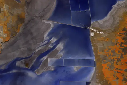
Credit: wyvern.space
Recent missions show that compact HSI on smallsats can deliver meter-class GSD with VIS–SWIR coverage, increasing revisit and enabling edge analytics for lower-latency reporting; a key consideration for any time-sensitive assessment while still adhering to responsible-use principles. Examples include:
- Orbital Sidekick GHOSt: ~512 bands (VIS–SWIR), ~3–8 m products, daily-like revisit, designed for infrastructure monitoring with defence use cases.
- Xplore XCUBE-1: publicly released ~5 m hyperspectral imagery and emphasis on edge processing/data fusion for defence and civil users.
- Wyvern: 5.3 m hyperspectral data with defence-oriented materials analysis messaging.
6 Data quality, calibration, and PED
- Radiometric & spectral calibration: In-scene and vicarious methods are essential to ensure that pre/post comparisons reflect real change, not sensor drift or atmosphere. AI-assisted approaches (e.g., AI-HyperCal) propose automating ground-truth tie-point identification to accelerate calibration.
- Geometric registration: Accurate co-registration between dates is critical in pushbroom HSI due to line timing and platform attitude/stability constraints; recent CubeSat studies document workable pipelines.
- Anomaly and target detection: RX/LRX/CRD/AED families and modern deep residual learning can flag spectrally atypical pixels; adding vegetation indices can improve performance but requires careful validation to manage false alarms.
7 Governance, ethics, and responsible use
- Compliance with doctrine and law: Within CA (BDA, CDA, MEA), HSI products should be documented with clear confidence statements and used to reduce uncertainty while avoiding any automated reattack bias.
- Minimising civilian harm: Employ conservative thresholds, independent review, and cross-cueing with non-imaging sources for humanitarian risk monitoring.
- Transparency & auditability: Maintain metadata (calibration, processing lineage) for post hoc reviews and accountability.
8 Simera Sense HyperScape100 for on-orbit assessment
Instrument overview: HyperScape100 is a compact VNIR (460–860 nm) pushbroom hyperspectral imager designed for CubeSats (≥3U).
- GSD: 4.75 m (500 km),
- Swath: 19.4 km (500 km),
- Spectral range: 460 nm to 860 nm in steps of 1 nm
- Spectral bands: 32 bands at a time, selected from 400 bands on the fly
- FWHM bandwidth: 3.5% of the selected Central Wavelength
Strengths for assessment
- Material sensitivity in VNIR: Useful for vegetation stress, coatings/paints, soils, and surface contamination characterisation in daylight conditions, aiding high-level pre/post change analysis.
- Compact SWaP: Enables constellation deployments for improved revisit to support timely post-event baselining and follow-up.
- On-board processing & storage: Supports pre-screening (e.g., anomaly maps), reducing downlink volumes and latency in the PED chain. Implemented with partners like Sidus Space, Unibap, KP Labs, and Zaitra.
Limitations to manage:
- Illumination dependence: VNIR performance is daytime and weather-limited; night or heavy cloud scenarios require complementary modalities (e.g., SAR, thermal).
- Spectral scope: Absence of SWIR/MWIR/LWIR bands limits certain mineral/thermal discriminants; mitigate via data fusion where available.
Example (non-operational) workflow on a satellite platform
- Tasking & acquisition: Schedule pre-event baseline collections to establish spectral libraries and site priors under similar sun sensor geometry.
- On board pre-screening: Use anomaly detection or band math indices to flag spectral outliers; store full cube plus compact alert layers for prioritised downlink.
- Ground processing: Apply AI-assisted calibration/registration; generate change maps and material class confidence layers for analyst review.
- Analyst exploitation: Fuse with multispectral, SAR, or RF to produce a high-level assessment note (BDA/CDA context) with explicit confidence & uncertainty statements in accordance with doctrine.
Platform integration considerations:
- ADCS & timing: Ensure stable attitude and precise time tagging to meet co-registration requirements for change detection.
- Downlink strategy: Balance full cube downlink for baseline building with alert-driven products for time-sensitive reviews.
- Constellation scaling: For responsive assessment, a cluster of HyperScape100-equipped satellites can improve revisit at modest SWaP.
9 Implementation roadmap (non-operational)
- Policy & governance: Define acceptable uses, approval chains, and documentation standards aligned with CA doctrine and IHL.
- Baseline library build-out: Acquire multi-season spectral baselines for priority areas to reduce false positives in change detection.
- Algorithms & validation: Stand up anomaly/change pipelines (RX/LRX + deep residual) and validate against controlled datasets with conservative thresholds.
- Fusion & PED: Integrate HSI outputs into existing ISR PED with explicit confidence annotation and red-team review for bias mitigation.
- Scale & sustain: Expand to a multi-satellite architecture if revisit requirements dictate; monitor calibration and model drift.
10 Example: AI model for ship detection
Hyperspectral data enables object detection by leveraging material-specific spectral fingerprints rather than relying solely on shape or colour, which is particularly useful for distinguishing ships from surrounding water or coastal vegetation.
In Metaspectral’s walkthrough using Wyvern’s Open Data from the Dragonette-001 satellite, analysts first inspect spectra in the 460–860 nm VNIR range (23 bands, ~5.3 m GSD) and observe clear separability—vegetation shows a pronounced red-edge rise, while ship pixels exhibit the opposite trend. Within the Fusion platform, they label pixels as “ship” versus “background”, then build a training set directly from those labelled spectra (or even from a single reference spectrum to synthesise training pixels), which grounds detection not in geometry but in spectral physics.
A compact deep-learning model trained on this dataset identified all ship pixels in the Suez Canal scene and achieved an extremely low false-positive rate (~4.5 × 10⁻⁵), demonstrating the value of spectral features for robust maritime object detection. The accessibility of Wyvern’s open, STAC-catalogued imagery further lowers the barrier to building and validating such models at scale.
Beyond ships, the same workflow generalises to other targets: establish spectral discriminants, label exemplars, and train a spatial-spectral detector that learns both what the object is made of and what it looks like.
Metaspectral’s guidance shows how Fusion streamlines this end-to-end process—upload, label, dataset creation, and model training—so teams can rapidly stand up target-detection models on hyperspectral cubes without heavy local infrastructure.
In parallel, open datasets from Wyvern provide diverse scenes for transfer learning and cross-site validation, improving robustness to background variability and illumination changes that often confound RGB approaches.
Research in hyperspectral object detection also supports combining spectral cues with spatial context to boost accuracy, reinforcing why deep models tailored to hyperspectral inputs perform well on cluttered backgrounds such as ports or coastlines.
11 Conclusion
References
- CJCSI 3162.02, Methodology for Combat Assessment (BDA/CDA/MEA).
- Shimoni et al., Hyperspectral Imaging for Military and Security Applications.
- IEEE GRSS article overviewing HSI for ISR.
- AI HyperCal (Army University Press), AI assisted calibration.
- Hupel & Stütz (Remote Sensing), anomaly detection for camouflage.
- Wang & Cui (MDPI), deep residual learning for HSI camouflage detection.
- Orbital Sidekick GHOSt (eoPortal).
- Xplore XCUBE 1 imagery press release.
- Wyvern defense hyperspectral data page.
- TIRSAT CubeSat on-orbit performance (MDPI).
- HyperScape100 specifications (WMO OSCAR; Satsearch; SatNow).
List of abbreviations
Abbreviation | Definition |
ADCS | Attitude Determination and Control System |
AED | Adaptive Eigenvalue Detector* |
AI | Artificial Intelligence |
AI‑HyperCal | AI‑assisted Hyperspectral Calibration |
BDA | Battle Damage Assessment |
CA | Combat Assessment |
CDA | Collateral Damage Assessment |
CRD | Collaborative Representation‑based Detector* |
EO | Earth Observation |
FWHM | Full Width at Half Maximum |
GHOSt | Global Hyperspectral Observation Satellite |
GSD | Ground Sampling Distance |
HSI | Hyperspectral Imaging |
IHL | International Humanitarian Law |
ISR | Intelligence, Surveillance, and Reconnaissance |
LRX | Local Reed–Xiaoli Detector* |
LWIR | Long‑Wave Infrared |
MEA | Munitions Effectiveness Assessment |
MWIR | Mid‑Wave Infrared |
PED | Process–Exploit–Disseminate |
RF | Radio Frequency |
RGB | Red–Green–Blue |
SAR | Synthetic Aperture Radar |
STAC | SpatioTemporal Asset Catalog |
SWaP | Size, Weight, and Power |
SWIR | Short‑Wave Infrared |
TTPs | Tactics, Techniques, and Procedures |
VIS | Visible (portion of the spectrum) |
VNIR | Visible and Near‑Infrared |